The extensive salt marshes on the Outer Banks of Carolina offer ideal conditions for unravelling the mysteries of sea level change during past centuries. Here is a short report from our field work there – plus some comments on strange North Carolina politics as well as two related new papers published today in Nature Climate Change.
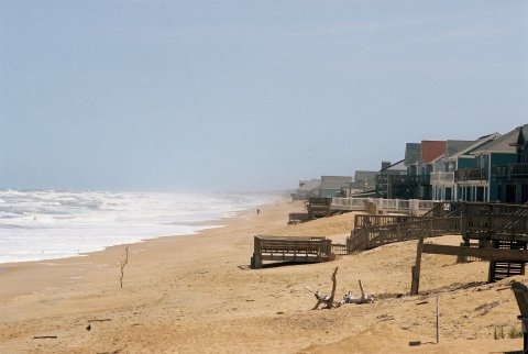
The Outer Banks of Carolina are particularly vulnerable to coastal erosion and sea-level rise, partly because the land is subsiding and the banks are naturally moving landward. On the ocean front, land is continually being lost.
At 11.20 AM we get a walky-talky call from the research vessel Stanley Riggs which anchors a bit offshore from us: a few meters behind us is a shark in the water they say. They’ve been observing it through their binoculars. We haven’t noticed a thing and turn around, but only the student Ray catches a glimpse of the fin before it disappears. We’re standing on a bit of peat surrounded on three sides by water, drilling a core. Sharks don’t bother us – but the people on the ship are worried about our divers who plan to go in the water shortly. We don’t see the shark again – only little snakes elegantly gliding past through the water, heads above the surface, and some crabs, a popular local delicacy.
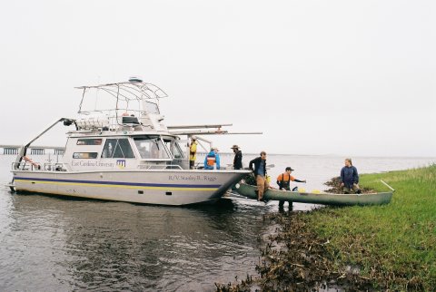
R/V Stanley Riggs lands our team at Sand Point.
To us as onshore crew, alligators would be far more interesting than sharks. Last week, not far from one of the study sites a man was injured by an alligator. My colleagues reassure me: alligators are nothing to worry about, as long as you can run faster than the slowest person in the group. But everything looks as peaceful as it can be now. The sun glitters on the lagoon, every now and then a group of pelicans patrols over our heads and convective clouds are billowing near the horizon. Sometimes we hear thunder rolling in the distance, but it stays dry all day. What a contrast to the previous day! A cold wind and constant rain bothered us and a series of technical failures meant that we did not even bring a useable core home. A dozen people worked a whole day in vain. (No hint that day of the fact that this May was the warmest on record in the Northern Hemisphere!)
The day I arrived on the Outer Banks I’d been greeted with news of a 50:50 chance of a tropical storm developing offshore. The same evening the first tropical storm of the season was called by the National Hurricane Center: Alberto. In mid-May – the hurricane season officially only starts in June (it turned out to be only the third May on record with two tropical storms in the Atlantic). The Outer Banks are very exposed. Several times in the last decades a hurricane caused a break in the barrier island and washed away the only road connection to the mainland. Luckily, Alberto turned offshore and passed far out at sea without bothering us.
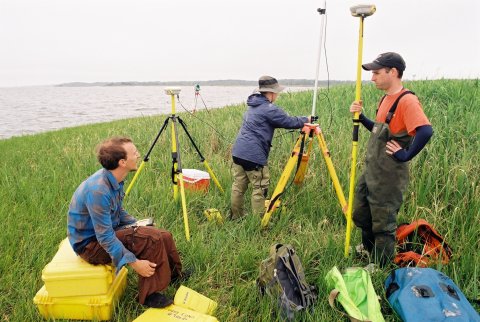
Andy Kemp (on right) with students Ray and Hanna.
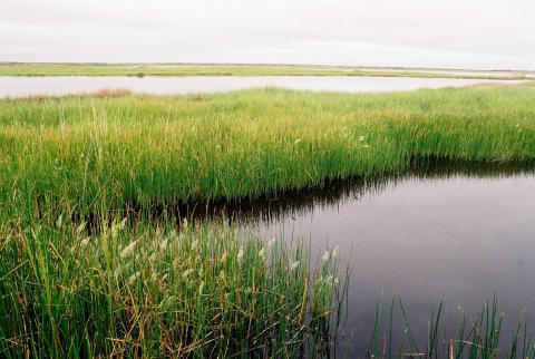
We’re here because of the several metres thick peat layer which has accumulated during the past millennia behind the Outer Banks. The land here is still sinking since the end of the last Ice Age, because it is located on the glacial forebulge: a zone around the edges of the glacial ice sheets that was pushed up when the ice load was pushing down adjacent lands. So instead of getting post-glacial uplift it suffers from post-glacial subsidence. The subsidence has led to a continuous sea-level rise relative to the land of around one millimetre per year. The salt marsh is able to keep up with this rise by accumulating sediments and building up peat, about a metre per millennium. This provides a unique opportunity to reconstruct the speed of relative sea-level rise – and by subtracting out the land subsidence, also the absolute sea-level changes.
I’ve already reported here on the previous results of our collaboration with the team around Ben Horton of the University of Pennsilvania: it was possible to reconstruct sea level for the past 2,000 years and to link the variations of the last 1,000 years to the global temperature evolution (see graph in that earlier post). Now we’re here to look for even older, thicker peat. Some of the oldest peat may well have been flooded in the meantime and be sitting at the bottom of the lagoon, hence we’re also coring from aboard the research vessel run by East Carolina University. After more than a week of coring, the peat is looking promising – but only months-long efforts in the lab will show whether the new cores are suitable for reconstructing sea level.
North Carolina politics
On the last day we hold a stakeholder workshop in Nag’s Head. NOAA, the funding agency, requires this type of direct discussion of the project scientists with potential users of the results, e.g. from local planning authorities. Sea-level rise is right now a hot topic in North Carolina: an interest group called NC20 has proposed a rather bizarre piece of state legislation that would ban the use in planning of scenarios of accelerated future sea-level rise (as recommended e.g. by the guidance document of the US Army Corps of Engineers, who assume a “high” scenario of 1.5 metres – about five foot – sea-level rise by the year 2100). And yes – NC20 was represented at our stakeholder workshop. Here is a leaflet that they distribute. The group tries to discredit the credibility of science by propagating the myth that climate science predicted global cooling in the 1970s. In truth this cooling idea was never main-stream but a small minority view also in the 1970s. CO2-induced global warming was in fact correctly predicted in classic papers e.g. in 1972 (Sawyer in Nature) and 1975 (Broecker in Science).
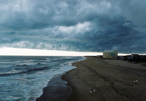
Dark clouds gather over the beach at Jennette’s Pier where we hold our stakeholder workshop. Not long after a thunderstorm strikes. The wide beach is artificial: result of a beach nourishment project for $ 36 million in the previous year. Environmentalists are critical of the beach nourishment. [All photos (c) S.R.]
Of course, global sea-level rise has already accelerated in the course of global warming (as many scientific papers have demonstrated – including the data from the peat cores in North Carolina), and will almost certainly accelerate further as the planet warms. After all, ice melts faster the warmer it gets, and the oceans also heat up faster. In other words, this law would have banned taking reality into account in planning. It was passed recently by the Senate of North Carolina, albeit with some rewording that softens up the central clause, but looks unlikely to become law this year. The Colbert Report has a rather funny comedy piece on the sea level law. This story was topped by a Senator from northern neighbour Virginia, who apparently said that “sea-level rise is a left-wing term”.
Two new papers
Nature Climate Change publishes two new sea-level papers today. One, by Sallenger et al., is an analysis of US tide gauge data. The main finding is that there is a “hotspot” of acceleration in sea level rise over the past sixty years on the US Atlantic coast, with the largest acceleration found between Cape Hatteras and Boston. The authors argue that this pattern is consistent with a weakening of the Atlantic overturning circulation (and hence their first reference is to our 2005 paper where we show this sea-level pattern in our model). In my opinion an intriguing possibility that warrants further investigation. There could be other causes, like interdecadal changes in the wind field.
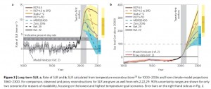
The other paper, by Schaeffer et al. (disclosure: I am a co-author on this) estimates global sea-level rise up to the year 2300 using a semi-empirical approach. The paper exploits the observed relationship between global temperature and the rate of global sea-level rise and was calibrated using the sea-level proxy data from North Carolina for the past millennium. For the main results, see the graph below, which also includes the proxy data (click to enlarge). Ironically, it is thus the historic data from North Carolina that lead us to rather grim expectations of future sea-level rise.
Links
More photos: see my US Atlantic Coast set on Flickr.
Press release for the Schaeffer et al. paper
Realclimate: 2000 years of sea level
Realclimate: Is sea-level rise accelerating?
Sea-level pages of the Potsdam Institute
Update: a few links to media articles about this topic
The Guardian: Scientists warn US east coast over accelerated sea level rise
New Scientist: Sea-level rise accelerates faster on US east coast
The Wall Street Journal: Sea rise faster on East Coast than rest of globe
Nature: US northeast coast is hotspot for rising sea levels
Le Monde (in French, quotes this Realclimate article)
Sea-level panel’s mainstream report – article by Rob Young, a member of the NC sea-level panel.



Does the AGW theory itself rely more on computer models or it based on paleo data?
surveyor7^2: Does the AGW theory itself…
Learn more efficiently, start here: Spencer Weart’s The Discovery of Global Warming
The Argument Clinic is here.
> surveyor ….
Neither of those is basic, though both help.
See the Science Links in the right sidebar?
The first one, to the AIP, has the background.
AIP, Spencer Weart’s “Discovery of Global Warming”
surveyor7^2 @101 — AGW is not a ‘theory’ but a consequence of the physics of planetary climates in the presence of heat-trapping gases when a source (humans) adds a plentiful supply of a heat-trapping gas, carbon dioxide. The most important principles of planetary climates are determined from experimental data; the ressults are used to construct climate models and to intrepret the paleo data.
I recommend reading “The Discovery of Global Warming” by Spencer Weart:
http://www.aip.org/history/climate/index.html
Surveyor7^2, the only thing anthropogenic about AGW is how additional CO2 is currently getting into the atmosphere. The rest is basic physics and chemistry.
You’ve been given good advice: read Spencer Weart’s book. I suggest you take it.
North Carolina lawmakers REJECT sea level rise predictions
no surprise, really, since Republicans control both houses of the North Carolina legislature.
only real question is, will Bev Perdue veto this errant nonsense?
Jim Eager:The only thing anthropogenic about AGW is how additional CO2 is currently getting into the atmosphere.
Heirloom quality expression.
After enduring national ridicule for proposing a bill to outlaw any coastal sea level projections based on climate change data, the state’s Republican-controlled Legislature came up with a compromise Tuesday. Lawmakers effectively put the sea level debate on hold by asking for more studies – but none that involve climate change.
N.C. to sea level forecasters: Ignore climate change data for now (LA Times)
Projections include continuing ridicule.
Xavier Onnasis,
The piece accuses the legislators of putting their head in the sand.
I’m sorry, but where those legislators have placed their head, sand would feel very uncomfortable.
Unfortunately, the corporate spending unleashed by the Supreme Court’s Citizens United decision has contributed to the Republicans taking over our state legislature for the first time in a long time. This has radically altered the state’s politics for the worse resulting in a multitude of legislative atrocities the sea level legislation being the most ridiculous. I have read that the group promoting this legislation is made up of coastal developers, whom I assume would be long gone with the money by the time the actual sea level rise exceeds dictated predictions leaving the people who bought the property to deal with the consequences.
re
It is sad to see money and ideology determining our government’s policies rather than reality.
Regarding “Hotspot of accelerated sea-level rise on the Atlantic coast of North America” published in Nature CC, I would like to know how the use of the IPCC’s A1B scenerio is justified when emission are currently tracked above the A1FI scenerio? How will this effect the projected results of future sea level rise?
I suspect I know the result (hotter and higher), but want confirmation.
Thank you all for your replies. I found the links useful.
The reason why I ask is that while I was discussing the issue with someone, they made the comment “the AGW theory does not rely on computer models”. I find the assertion vague and he wouldn’t elaborate on the assertion. When I researched the issue, I found that although Arrhenius didn’t have access to computer models, he did use simple models and mechanical models we used by others doing the early research. I also found in the links you gave that climate scientists have been using computer models since the middle of the 20th century to advance, test and validate the theory.
Is the assertion, “the AGW theory does not rely on computer models” make any sense and if not how important are they? I’m not sure that answer can be found at Wearts website.
Surveyor7^2,
Computer models are just an expression of the physics in a scientific model. You can do the same with pencil and paper in a simplified fashion. Computer models are useful tools. They allow us to explore lots of different possibilities that add to our understanding of the one realization we see in our world. They add understanding, but they are by no means the basis of anthropogenic climate change–that’s just physics.
Elaborating on Ray’s remarks, Newton successfully modeled extremely simple gravitational effects with equations executed by hand. Later we find the same equations run on computers and used to successfully fly spacecraft within 200km of a moon orbiting a planet some 630 million kilometers distant despite complex gravitational dynamics. Running Newton’s simple equations on a computer allows them to be applied to a problem beyond the speed and accuracy of human ability but at root the same physics and same mathematics are being performed.
Don’t get too hung up on the term “computer model.”
So do you two agree that the AGW theory does rely on computer models?
Or can that be answered with a yes or no?
Surveyor7^2, all of science uses models. That’s what a hypothesis is: a model of the phenomena being studied. Those models, or hypotheses, are tested to compare them to reality, to see how accurately they describe and make predictions about the real world, and they are revised as necessary.
In fact, all of science is a model of physical reality as we currently understand it. As new data and observations become available, the model that is science evolves to take them into account and is then retested, and by doing so our understanding expands.
Re: #114 (surveyor7^2)
It depends on what you mean by “computer model.” If you mean a mathematical or physical model, for which we just happen to use a computer to do the arithmetic, then all the commenters who are trying to beat you over the head with “all science is models” are right. Pay attention to them, because if that’s what you mean by “computer models” then your question is useless. Science is modeling reality, and using a computer to do the arithmetic is just plain smart — not doing so is just plain stupid.
If you mean simulations of climate, in which a computer calculates the time evolution of the atmosphere, ocean, possibly ice sheets and sea ice and plant growth and carbon dissolving in the ocean and glaciers melting and so on and so forth etc. etc., all based on our best understanding of how those things work (most of which is basic laws of physics), and which requires so much arithmetic it can only be done with computers, then I can answer your question definitively: No. AGW theory does not rely on computer models. Period.
They are, however, the best tool we have to make predictions.
“So do you two agree that the AGW theory does rely on computer models?”
Nope. You could divide up the calculations amongst a hundred million science and math graduate students, and it would take a hundred or thousand times longer – to get the same answer. Math is math. Most of the time, the math quantifies a measurement, which has some inherent and quantifiable error, like the temperature, or the mass of the carbon and oxygen atoms, and the bond strengths between them in a CO2 molecule, which determine the frequency and strength of the infrared absorption. Sometimes the math is purely counting – like when you calculate blackbody radiation from first principles, T appears as a multiplier 4 times – so blackbody radiation varies with the fourth power of temperature, not somewhere in between t^3.99 and t^4.01, depending on how Anthony Watts is holding his mouth on a given day. The math doesn’t change because the model calculations are being done quickly and efficiently by computer instead of paper and pencil.
Don’t let yourself get confused by some slick denialist conflating wrong(inaccurate) with wrong(conceptually), like Pat Michaels in his congressional testimony saying that since the error bars on aerosol forcing range from zero to -2w/m^2, that this allowed so much wiggle room that he could “give you any answer you want”; this is a lie – there is no way he can honestly give you an answer that has positive aerosol forcing – that’s outside the range of the error bars, and the best estimate is a negative forcing, which he chose to ignore, in order to get the answer HE wanted, that climate sensitivity is low.
Oh, wait, there’s a better way: take my standard advice and apply it.
Ask the scientists at the PIOMAS site, not some guy on a blog!
Start with what they have posted on their website.
Read the paper they link to.
Ask questions the smart way.
Their choice of time frame is pretty smart. A study period until 2015 may hold off economy-wrecking opposition. That deadline will also motivate owners and developers to get ‘er built by 2015.
North Carolina is encouraging a bubble. They’re fun on the upslope, but when everybody agrees that the shiny new developments will be uninsurable at rational rates in some number of decades, some folks are going to be left holding the bag.
Develop now and get it all sold by 2015.
Surveyor7^2,
Define “rely”. Certainly, you do not need a computer model to show that adding CO2 to the atmosphere will warm the planet. Pen and paper along with the absorption spectrum of CO2 is sufficient for that. What computer models do is add understanding. In fact, they are among the most important tools for limiting CO2 sensitivity on the high side as well as the low.
Computer models are not necessary to demonstrate that warming is a threat. Without them, they are an unbounded threat.
Surveyor, find out what “rely” means to this friend of yours.
If he’s using “rely” to mean “can’t stand up without leaning on” — not so.
If he’s using it to mean “helps improve understanding” — yes, they do.
Show him Spencer Weart’s history. Much was undrstood before the first modern computers were built. Much calculation was improved on by using computers.
If he doesn’t want to read the history, or have it read to him, then he’s just copypasting what he thinks is a clever trick question and isn’t interested in the answer.
Surveyor7^2: I am not clear what you mean by ‘AGW theory’. Do you mean the fact that CO2 absorbs in the infrared? Or that the level of CO2 in the atmosphere is increasing? Or the fact that the increase in CO2 is coming from human activity? Or the prediction that this will cause global temperatures to increase? Or possibly the observation (from multifarious sources) that global temperatures are increasing? None of these are scientific theories and none of them require the use of computers.
Where computers come in useful is to churn through the vast amounts of data needed to get a fairly detailed understanding of what is going on and what is likely to happen.
I also do not understand why ‘model’ is a dirty word to climate change denialists. A climate model is really just a mathematical description of how climatologists understand the system to work which can then be compared against reality. If it seems to be close, then it may be possible to make some sort of predictions from it. It’s rather like a car designer making a model of a car (these days, in a computer) to study how it might react in a cross-wind or even how potential buyers react to its appearance. Do those who object to climate models also object to car models? If not, why not?(
@Surveyor7^2: It’s difficult to give an answer because the question is so strange. It’s like asking if automobiles rely on robots. You could argue “Yes, most mass-produced automobiles today are at least partially assembled and finished using robotic technology.” Or you could say, “No, automobiles can be, have been and are produced without them.” Both are correct but probably uninformative. The informative part could be derived by asking what the questioner thinks the assertion implies which is what Richard Simmons discusses @122.
Anyone who anticipates something about what the future may hold is using a model. Some models are more detailed and rigorous than others. Anyone who wants to convince others to disregard physics-based climate simulation models should be ready with good evidence that they have a superior alternative model, otherwise they’re essentially saying that since you don’t have perfect vision, you should walk around with your eyes closed.
It’s an amazing thing how nutters can confound perception and generate a lot of unnecessary commotion by making the obvious toxic. Scientists use computers. Once upon a time they used slide-rules. Did people get their knickers in such a twist over “slide-rule modeling”?
Computers can has bad joo joo, must fling pooh.
Almost every time someone asks a “yes or no” question, the correct answer is “it depends.” This is especially true in fields that rely upon evidence and reason instead of polemics and ideology. Often the question itself has many implicit assumptions the person posing the question didn’t even realize when asking.
Hi folks, I am a seismologist that teaches an intro geology class. I struggle a bit with explaining at what time scale global average temperatures become meaningful in understanding climate change. I’ve heard about 15 years, but was wondering how that number is arrived at. Is it from simply looking at the time series? Or is it more from prior knowledge that various oscillations will be averaged out over that time period. Thanks!
DS, the time period is a property of the time series data set itself. Robert Grumbine has a good post on the subject here:
http://moregrumbinescience.blogspot.ca/2009/01/results-on-deciding-trends.html
Tamino also did a post on this at Open Mind, but I can’t find my link to it right now.
DS,
One way I like to think of it, for the global average temperature, would be 15 years of data on either side of the point where you want to know what the trend is. This leads to a common talking point you might hear from some “it hasn’t warmed in the last decade” or so. People will look 15 years ago and curve of the temps forward from that point. You need to use data on both sides of the point to establish the trend at that point. So the past 3 decades of data will tell us what the trend was 15 years ago.
I hope I haven’t over simplified this, and if I’m inaccurate someone better informed here will correct me I’m sure.
DS @127 — At least 30 years of data are required, according to WMO. Checking the actual ‘natural’ variations and applying standard statistical measures, one concludes than 30 years isn’t actually long enough to average out those variations. If I remember rightly, 45 years is the minimum based on the various global surface temperature products, GIStemp, HadCRUT and the one from NOAA’s NCDC.
Re: #127 (DS)
For the time span needed to achieve statistical significance, see this post. As for “meaningful,” perhaps that’s a value judgement?
122 Richard said, “I also do not understand why ‘model’ is a dirty word to climate change denialists. A climate model is really just a mathematical description of how climatologists understand the system to work which can then be compared against reality”
It’s a matter of trust. Denialists sincerely believe something similar to:
Top climate scientists got there by cheating. They are a sort of mole, their primary goal is to warp the science to fit their masters’ agenda, which is to prevent the advance of climate science, and instead spread lies long enough to allow for the myth of imminent catastrophe to initiate the overthrow of the free world and its replacement with a small cohort of human hunter-gatherers.
So, looking through un-rose-colored glasses, a climate model is just a mathematical description of climatologists’ agenda, which can then be twisted (via techniques such as adjusting past temperatures downward) to encompass the generally falsifying data flowing in.
Whenever you see a time span stated, ask for a cite to the source; then look at whether the source is giving the usual ballpark number, or giving an actual calculation. The actual answer depends on exactly what data set is used and on various assumptions. If those aren’t provided, it’s a ballpark estimate. Robert Grumbine and Tamino give answers with the required details. They don’t disagree, they describe the particular example they use and how it’s done.
#132–
The best satire is often the result of taking its object with (apparent) deadly seriousness…
IOTW, thanks for a nice reductio, Jim!
I’d only add that one of the memes revealed by the “Phil Jones hatemail” linked on another thread was that climate science (and, we must presume, related policy) has somehow been responsible for many thousands of deaths in the developing world by killing economic growth there)–this, despite the very publicly available facts that:
1) Kyoto specifically excluded the developing world, and
2) Economic growth rates there have generally been far higher than in the “developed world” for a decade or more, and public health measures have been showing concomitant improvements.
Call it an ugly theory slain by beautiful fact.
DS,
There is no magic number regarding the time scale for global temperatures. The AMS uses the last 3 decades as its average temperature, when comparing recent temperatures to the averages. Temperatures changes can occur over much shorter timeframes, depending on several factors, so waiting three decades may not be necessary. At other times, much longer timeframes are necessary to witness any changes. Oscillations have historically been averaged out over longer timeframes, typically 60 years, or 120 years for two cycles (30 years can be deceiving, if it occurs on either the high or low side of the cycle).
May I ask a stupid question? Will the volume of voids from underground caves, lava tubes etc. that have not been inundated until now not cause a lag in sea level rise?
Sorry, it’s probably a really dumb question. It’s just that I have been wondering what the void space in the earth’s crust could be… A bit like a sponge, if there are lots of voids and until now they had not been flooded, when the sea starts to seep in, wouldn’t it take a long time before they were filled and we began to see a sensible SLR on the surface?
Toni: …when the sea starts to seep in, wouldn’t it take a long time before they were filled and we began to see a sensible SLR on the surface?
The only truly stupid question is one that goes unasked. The real risk of stupidity comes with listening to answers from dilettantes (me and myriads of others).
All the same this seems like a question amenable to reckless and half-informed speculation.
Picturing the problem with excessive groundwater withdrawal from shallow aquifers near the ocean yields a suggestive answer. Overpumping a shallow aquifer in contact with a seacoast tends to result in seawater invading the aquifer. That’s a telltale that the land near the ocean at and below sea level is already saturated with seawater.
Short of having some really enormous (outlandish “hollow Earth” science fiction scale) voids that are somehow still dry while still being open to flooding by seawater the accounting for void spaces is already taken care of automatically; the observed sea level rise rate already incorporates progressive flooding of pore and void space.
Toni @136 — Briefly, no. At more length: mostly the ground pores and larger voids are full of water, sometimes quite fresh and sometimes exceedingly salty. When ground water is pumped out near most seacoasts the ocean water invades. Further inland pumping causes the pores to collapse so the rechange rate is slowed.
SLR will progress almost independently of the degree of invasion of ocean water under the ground as this simplly displaces some of the fresher water.
[Disclaimer: I’m an amateur at this, but I’ve been an amateur geologist for over 50 years now.]